
Wind chill hitting -30 is about to slam the Greater Toronto and Hamilton Area Monday morning, and Environment Canada isn’t fooling around. They’ve thrown yellow cold warnings across eight regions.
The weather folks issued these warnings Sunday afternoon for Caledon, Hamilton, Halton Hills-Milton, Mississauga-Brampton, Newmarket-Georgina-Northern York Region, Pickering-Oshawa-Southern Durham Region, Uxbridge-Beaverton-Northern Durham Region, and Vaughan-Richmond Hill-Markham.
Time to dig out that winter coat you thought you’d packed away.
- Wind chill values: -25 to -30
- Timing: Monday morning
- Areas affected: 8 GTHA regions
- Warning level: Yellow (extreme cold)
- Toronto wind chill: -18 overnight
The Places Getting Smacked Hardest
Weather models are all singing the same tune on this Arctic nightmare. We’re talking classic March madness that’ll make your Monday commute feel like punishment.
Caledon and northern York Region? They’re getting the worst of it. Always happens when Arctic air comes barreling down from Hudson Bay. Those lake-effect zones along the north shores just make everything worse.
Hamilton’s in the crosshairs too. Anyone driving the QEW between Burlington and Stoney Creek better leave early. Cold air loves those valleys around the escarpment, and once it settles in, it doesn’t budge.
Both parts of Durham Region are going to suffer. Highway 7 or the 401 through Pickering and Oshawa? Make sure you’ve got that emergency kit. Nobody wants to get stuck in this mess.
We’re talking 2.7 million people across the GTHA dealing with this. Mississauga-Brampton alone has 1.4 million folks who’ll wake up to dangerous conditions Monday.
Hamilton adds another 580,000 residents. Throw in York and Durham communities, and that’s nearly half of Ontario facing extreme wind chill warnings.
What -30 Wind Chill Does to You
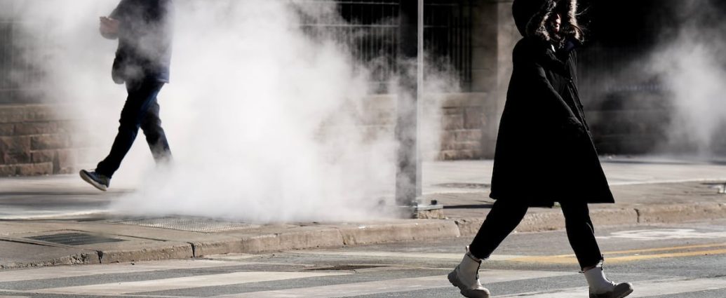
Look, wind chill isn’t just some number on your phone. At -30, your skin can get frostbite in under 10 minutes. That’s barely enough time to scrape ice off your windshield.
“Extreme cold puts everyone at risk. Risks are greater for young children, older adults, people with chronic illnesses, people working or exercising outdoors, and those without proper shelter,” Environment Canada warned.
They’re not messing around with the language here (no, seriously). When they say “extreme cold” and keep hammering the frostbite risk, listen up. Cover every bit of skin you can, especially face and hands.
That morning dog walk you were planning? Make it quick. Environment Canada’s pretty blunt about it: “If it’s too cold for you to stay outside, it’s too cold for your pet to stay outside.”
Keep moving, find shelter from the wind. Those gusts turn a manageable -15 into a brutal -30 experience.
Here’s the math that should scare you: at -30 wind chill, exposed skin feels the same as -30 actual temperature with no wind. Forecast winds of 25-35 km/h across warning areas will turn air temperatures around -18 to -22 into those bone-chilling -30 values.
And here’s something that’ll really get your attention.
Statistics Canada shows cold-related emergency room visits spike 40% during extreme cold warnings. Hospitals across the GTHA are already getting ready for Monday, especially for seniors and people with heart problems.
Toronto Scrambles for More Warm Spots
Even though Toronto didn’t get hit with an official warning, city officials aren’t taking chances (yes, really). Wind chill hitting -18 overnight was enough to open two more warming centres Sunday at 5 p.m.
They fired up Cecil Community Centre at 58 Cecil Street and Jimmie Simpson Recreation Centre at 870 Queen Street East. The city’s other five warming centres stay open too.
Seven warming centres total now. That should tell you how seriously they’re taking this cold snap.
Timing couldn’t be worse either. Early March usually brings hints of spring, not Arctic wind chills that rival January’s nastiest days.
Toronto’s warming centre network can handle up to 450 people across all seven spots. Cecil Community Centre adds 35 beds, while Jimmie Simpson Recreation Centre provides space for 40 people. Both opened their doors exactly at 5 p.m. Sunday and won’t close until temperatures get reasonable again.
The city’s 2021 Street Needs Assessment found 8,715 people experiencing homelessness in Toronto. During extreme cold like this, warming centres typically hit 95% capacity. Social services teams have been doing outreach since Saturday, letting rough sleepers know where they can get warm.
“Keep moving to maintain your body heat and seek shelter from the wind,” Environment Canada’s warning states, advice that becomes life-or-death for Toronto’s most vulnerable residents.
These additional centres represent an emergency protocol that’s only been triggered 12 times in three years. Last time Toronto opened emergency warming centres was January 2024, when wind chill dropped to -35 in parts of the city.
Monday Morning Commute: Just Don’t
If you can work from home Monday, seriously, do it. The worst wind chill hits during morning rush, and that’s when stepping out of warm buildings becomes torture.
Transit riders need to layer up and don’t wait outside any longer than absolutely necessary. Subway platforms and bus stops offer zero protection from wind, and standing still in -30 wind chill is asking for frostbite.
Drivers, give your car extra warm-up time. But don’t idle it in the garage or anywhere enclosed. Carbon monoxide doesn’t care how cold it’s outside.
Keep that emergency kit ready: blanket, water, snacks, phone charger, and definitely a snow brush.
School bus cancellations haven’t been called yet for Monday, but don’t be surprised if some boards make that decision Sunday night. Bus drivers and transportation supervisors are watching conditions closely.
The TTC typically sees ridership drop 15-20% during extreme cold warnings as commuters drive or work from home instead. Monday’s morning rush could see similar patterns, with GO Transit also preparing for potential service changes if conditions get worse overnight.
Highway 401 through the warning zones will be nastiest between 6 a.m. And 9 a.m. Monday. OPP reminded drivers to carry emergency supplies during cold weather. Last winter alone, they responded to 847 cold-related highway incidents during extreme weather warnings.
Pearson International Airport is monitoring things closely but hasn’t issued any early flight delays. Ground crews will face challenging conditions during Monday morning departures though.
De-icing operations typically take 25% longer when wind chill drops below -25.
Health Risks You Need to Know About
The medical community is taking this seriously. Toronto Public Health activated its cold weather response Sunday evening, which means extra outreach to vulnerable populations and coordination with hospital emergency departments.
Hypothermia can start within 30 minutes of exposure to -30 wind chill. Early signs include uncontrollable shivering, drowsiness, and confusion. Frostbite hits exposed skin even faster, with fingers and toes getting hit first.
Paramedic services across the GTHA have adjusted Monday morning staffing. Peel Region Paramedics added two extra units to their morning deployment, while York Region EMS moved additional crews to northern stations where the coldest conditions are expected.
People with heart conditions face bigger risks during extreme cold. That sudden temperature shock when you go from heated indoor spaces to brutal outdoor conditions can trigger cardiac events. Heart doctors recommend warming up vehicles remotely when possible and avoiding long outdoor exposure.
Emergency departments at Hamilton Health Sciences and Trillium Health Partners have prepared extra blankets and warming supplies. Cold exposure cases typically jump 60% during extreme weather warnings, with kids under five and adults over 65 representing the highest risk groups.
When Does This Arctic Nightmare End?
Good news? This isn’t sticking around forever.
Weather models show temperatures bouncing back by Tuesday, with more normal conditions returning midweek.
Monday’s the worst of it. Wind chill values should ease up through the afternoon as winds calm down.
By Wednesday, we could see highs pushing close to freezing again, which’ll feel like a heat wave after Monday’s shock.
But don’t pack away the winter gear yet.
March in Ontario is famous for these late-season cold snaps, and spring’s still weeks away. The Great Lakes are still cold enough to generate nasty squalls when weather patterns shift.
Right now, just focus on getting through Monday morning safely. Layer up, limit outdoor time, and remember that frostbite doesn’t give you warning signs. When Environment Canada issues yellow cold warnings, they mean business.
Long-range forecasts show temperatures climbing back to seasonal norms by Thursday. March averages in the GTHA typically range from -2°C overnight to +5°C during the day. This Arctic blast represents a departure of 20-25 degrees below normal for early March.
Weather models show the cold air mass retreating northward by Tuesday afternoon, pushed out by a warmer Pacific system approaching from the west. Wind chill values should improve to the -10 to -15 range by Tuesday morning. Still cold, but way more manageable than Monday’s dangerous conditions.
What This Means for Everyone in Ontario
This cold snap affects way more than just comfort levels.
Energy use typically jumps 30-40% during extreme cold warnings as heating systems work overtime. Hydro One and Toronto Hydro have both reminded people to conserve electricity during peak morning and evening hours.
The farming sector is watching closely too. March is seeding preparation time for many Ontario farms, and this cold blast could delay field work by a week or more. Fruit growers in the Niagara region are particularly worried about potential damage to early budding trees.
Small businesses in the affected regions could see revenue drops of 15-25% on Monday as customers avoid unnecessary trips outdoors. Retail locations, restaurants, and service providers typically see significant decreases in foot traffic during extreme cold warnings.
Extreme weather events cost Ontario an estimated $1.2 billion annually. Monday’s cold snap won’t approach that scale, but it’s the type of weather disruption that’s becoming more common due to shifting climate patterns.
Public health officials stress that extreme cold events like this require community awareness and preparation. The eight regions under warning represent economic engines for Ontario, and keeping residents safe during these weather events protects both public health and economic stability.
For the 2.7 million people waking up to extreme wind chill warnings Monday morning, the message is crystal clear: take this seriously, plan ahead, and don’t underestimate how quickly dangerous cold can mess with your health and safety.
Frequently Asked Questions
How cold will it feel in the GTHA Monday morning?
Wind chill values will range from -25 to -30 across eight regions in the Greater Toronto and Hamilton Area.
Which areas are under the cold warning?
Caledon, Hamilton, Halton Hills-Milton, Mississauga-Brampton, Newmarket-Georgina-Northern York Region, Pickering-Oshawa-Southern Durham Region, Uxbridge-Beaverton-Northern Durham Region, and Vaughan-Richmond Hill-Markham.
How quickly can frostbite develop in -30 wind chill?
Frostbite can develop within minutes on exposed skin, especially with wind chill values of -30.