
Kelowna, B.C. is Canada’s highest wildfire-risk city for 2026, a new national study has found, and the reason is not the weather. The Okanagan city topped the ranking even though several Prairie centres face far harsher forecast fire conditions this season. What pushed Kelowna to number one was how tightly its homes and infrastructure are built into the surrounding forest.
The study, from insurtech firm MyChoice Financial, Inc., assigned Kelowna a wildfire risk index (WRI) score of 6.8 out of 10. That result captures a worsening pattern across much of Western Canada: neighbourhoods steadily spreading into wildland areas where people and fire increasingly share the same ground.
Why Kelowna is Canada’s highest wildfire-risk city
Kelowna’s top placement was driven by what the firm calls “extremely high community exposure.” That exposure comes from dense wildland-urban interface (WUI) development, the forest fuel ringing the city, and a long history of wildfire activity nearby.
“While Prairie cities recorded more severe forecast fire weather conditions, Kelowna’s extremely high community exposure, driven by dense wildland-urban interface (WUI) development, surrounding forest fuel, and historical wildfire activity, pushed it to the top overall.”
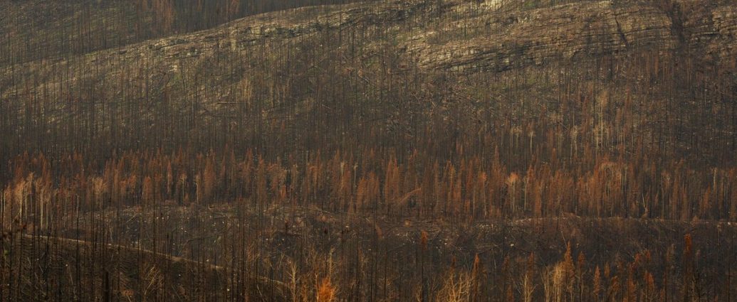
The Okanagan knows this risk first-hand. The McDougall Creek wildfire was photographed burning on a mountainside above a lakefront home in West Kelowna on August 18, 2023, a stark image of how fast fire can reach the doorstep of a populated area.
How is the wildfire risk index calculated?
The wildfire risk index combines two equally weighted parts, each worth half a city’s score: forecast fire weather severity (FFWS) and community exposure. One measures how dangerous the weather is expected to be; the other measures how vulnerable the built environment is. A city can score high on either, or both.
To build the index, MyChoice analyzed Canada’s 2026 wildfire outlook using Natural Resources Canada’s newly upgraded Canadian Wildland Fire Information System (CWFIS) Seasonal Forecast 2.0. The system introduces a new forecasting methodology based on Environment Canada climate modelling.
- Forecast fire weather severity (50%): uses factors such as a forecast severity rating, the expected intensity of wildfire-weather conditions, and the estimated number of extreme fire weather days (EFWD), meaning days with unusually dangerous fire weather.
- Community exposure (50%): weighs proximity to forests and the WUI, surrounding vegetation and fuel load, historical wildfire activity nearby, development pressure in hazard-prone areas, and how remote a community is for suppression crews to reach.
Where is the worst fire weather expected in 2026?
The most severe forecast fire weather sits well east of Kelowna. Regina recorded the country’s highest FFWS score at 9.8 out of 10, followed by Winnipeg at 9.5. Behind them came Medicine Hat, Brooks and Lethbridge in Alberta, along with Saskatoon, which the firm tied to “projected drought, heat, and elevated grassfire conditions across the Prairies during the 2026 fire season.”
B.C.’s coast braces for the most extreme days
British Columbia’s coast posted its own warning signs. Victoria and Vancouver recorded some of the highest extreme fire weather day forecasts in Canada. Victoria is projected to see 11 extreme fire weather days during its August peak, the highest of any city analyzed, while Vancouver was close behind at 10.5, despite more moderate overall severity scores.
The communities most exposed to catastrophic loss
Some places rank among the highest-risk not because of this season’s weather, but because of where and how they are built. Kamloops in B.C. and Fort McMurray, Canmore and Banff in Alberta were flagged as among Canada’s most structurally exposed wildfire communities, scoring extremely high on dense forest adjacency, difficult evacuation dynamics, historical wildfire proximity, and a high concentration of homes inside the WUI.
Fort McMurray is the study’s sharpest contrast. The new methodology projects relatively low wildfire-weather severity there in 2026, yet it still ranks among Canada’s highest-risk communities because of its extreme structural exposure and its history of catastrophic loss, including the 2016 disaster that remains Canada’s costliest natural catastrophe at more than $4 billion.
Ontario’s risk was rated “moderate” overall, but Northern Ontario stands apart. Kenora ranked as the province’s highest wildfire-risk city at 4.9 out of 10, with Timmins, Sudbury, Gravenhurst and Sault Ste. Marie also recording elevated exposure scores tied to forest proximity, remoteness and suppression-access challenges.
What this means for Canadians
The findings mark a shift in how wildfire danger should be understood. Two distinct patterns are emerging. Prairie cities are bracing for the most severe fire-weather conditions, while many B.C. and Alberta communities rank highly because of long-term development pressed up against the forest.
“Canada’s wildfire risk profile is becoming increasingly shaped by where and how communities are built, not just by the weather itself.”
That observation, from MyChoice CEO Aren Mirzaian, is the study’s core message. As he put it, some cities may face only moderate seasonal fire-weather conditions this year “but still remain highly vulnerable because homes, infrastructure, and evacuation routes are deeply embedded within forest-adjacent areas.”
For households in interface communities, the practical takeaway is clear: your personal exposure depends as much on location and preparedness as on any single season’s forecast. A lower fire-weather outlook, as Fort McMurray shows, is not the same as safety. Knowing your evacuation route, reducing fuel near your home, and tracking the official seasonal outlook from Natural Resources Canada matter regardless of where your city lands on the ranking.
For more coverage as the 2026 season develops, follow our National News reporting and our weather hub for the latest conditions across the country.
Frequently Asked Questions
Which is Canada’s highest wildfire-risk city for 2026?
Kelowna, B.C. was ranked Canada’s highest overall wildfire-risk city for 2026, with a wildfire risk index score of 6.8 out of 10. Its top placement was driven by dense wildland-urban interface development, surrounding forest fuel and a long history of wildfire activity nearby.
How is the wildfire risk index calculated?
The index combines two equally weighted components, each worth half the score: forecast fire weather severity, which measures expected intensity and the number of extreme fire weather days, and community exposure, which considers forest proximity, fuel load, past wildfire activity, development in hazard zones, and suppression access.
Why does Fort McMurray rank as high-risk despite a lower fire-weather forecast?
Fort McMurray is projected to have relatively low wildfire-weather severity in 2026, but it still ranks among Canada’s highest-risk communities because of its extreme structural exposure and its history of catastrophic loss, including the 2016 disaster that cost more than $4 billion, Canada’s costliest natural catastrophe.
Which Canadian cities have the worst forecast fire weather in 2026?
Regina recorded the highest forecast fire weather severity score at 9.8 out of 10, followed by Winnipeg at 9.5. Medicine Hat, Brooks and Lethbridge in Alberta and Saskatoon followed, reflecting projected drought, heat and elevated grassfire conditions across the Prairies.