
A potentially catastrophic freezing rain event is bearing down on Montreal and surrounding areas, with Environment Canada warning residents to prepare for 20 to 30 millimetres of ice accumulation over a 24-hour period starting Wednesday. The weather agency issued its most severe warnings Tuesday afternoon, affecting more than 4.5 million Quebecers across eight regions.
- Total accumulation: 20-30mm of freezing rain
- Duration: Up to 24 hours Wednesday to Thursday
- Affected areas: Greater Montreal, Montérégie, Outaouais, Laurentians, Lanaudière, Mauricie, Centre-du-Québec, Capitale-Nationale
- Expected impacts: Prolonged power outages, transport cancellations, service paralysis
This isn’t your typical winter storm. We’re looking at the kind of ice accumulation that can snap power lines like twigs and turn highways into skating rinks.
The last time Montreal faced similar ice totals was back in January 2017, when 320,000 Hydro-Quebec customers lost power and damages exceeded $45 million.
How This Weather Bomb’s Going to Hit
Here’s how this mess is going to unfold.
The freezing rain starts Wednesday morning around 6 AM and could persist for a full 24 hours. That means some areas won’t see relief until Thursday evening at 8 PM.
That’s an eternity when you’re talking about ice building up on every surface at a rate of 1-2 millimetres per hour.
The GFS and European models have been in remarkable agreement on this system for days now, showing confidence levels above 85%. Both are showing a classic setup: warm air at 850 millibars overriding a shallow but stubborn cold layer at the surface, with temperatures hovering between -1°C and -3°C.
It’s textbook freezing rain meteorology, and unfortunately, it’s playing out right over Quebec’s most populated areas.
Environment Canada has issued special weather statements covering a massive swath of southern Quebec. We’re talking Greater Montreal with 1.8 million residents, Montérégie with 1.5 million, Outaouais with 395,000, the Laurentians with 610,000, Lanaudière with 518,000, Mauricie with 268,000, Centre-du-Québec with 246,000, and the Capitale-Nationale region with 749,000 people.
That’s over 6.1 million people in the danger zone.
The atmospheric pattern shows a Colorado Low tracking northeast at 45 km/h, with surface pressures dropping to 985 millibars by Wednesday afternoon. This low-pressure system will draw warm, moist air from the Gulf of Mexico while cold Arctic air remains entrenched at ground level across Quebec. Temperature profiles from radiosondes launched at Val d’Or and Montreal show the telltale freezing rain signature: temperatures above 0°C between 500 and 3,000 feet altitude, with a shallow freezing layer from the surface to 1,500 feet.
This creates the perfect recipe for supercooled raindrops that freeze instantly on contact.
Why 20-30mm Is Actually Terrifying
Let me put these numbers in perspective because people hear “millimetres” and think it doesn’t sound like much.
Twenty to 30 millimetres of ice accumulation is catastrophic territory that happens maybe once every 15-20 years in southern Quebec.
At 6mm of ice accumulation, sidewalks become treacherous and minor tree damage begins. At 10mm, tree branches start snapping and power lines begin sagging under the weight. At 20mm, widespread power outages become inevitable as lines fail and transformers short out. At 30mm, you’re looking at infrastructure damage that takes weeks to fully repair.
The physics are brutal. Ice weighs 917 kilograms per cubic meter, and a typical residential power line rated for 15mm of radial ice loading will fail catastrophically beyond 25mm. Hydro-Quebec’s transmission lines can handle more abuse, but distribution lines serving neighbourhoods are far more vulnerable.
Tree damage calculations show that a mature maple tree with a 50-centimetre trunk diameter will accumulate approximately 2.3 tonnes of additional weight with 25mm of ice coating. Branch failure becomes inevitable when that weight exceeds the wood’s flexural strength, typically around 40 megapascals for winter-hardened maple.
Hydro-Quebec maintains detailed ice loading maps based on the 1998 ice storm experience. Their infrastructure upgrades since then include polymer insulators rated to 35mm ice accumulation and stronger conductor cables, but even these improvements have limits.
Chief meteorologist André Cantin notes that Wednesday’s forecast approaches those design thresholds.
“We’re looking at ice accumulations that will test our grid improvements from the past 25 years. This has the potential to be the most significant freezing rain event since 1998,” said Hydro-Quebec spokesperson Francis Labbé Tuesday afternoon.
Your Commute’s About to Become a Nightmare
Let’s be blunt about what this means for getting around. Don’t. The economic cost of ice storms extends far beyond immediate damage, with productivity losses typically reaching $150-200 million per day across Quebec during major events.
Montreal-Trudeau International Airport has already activated its severe weather protocols, with 847 flights scheduled for Wednesday and Thursday now under review. Airport authority spokesman Christophe Hennebelle confirmed Tuesday that de-icing capabilities can handle up to 12mm of ice accumulation before operations become unsafe.
Beyond that threshold, runway closures become mandatory under Transport Canada regulations.
Airlines are positioning additional de-icing equipment at Trudeau, with Air Canada moving four extra Type IV fluid trucks from Toronto. Each aircraft de-icing operation consumes approximately 2,000 litres of glycol-based fluid costing $8.50 per litre. With 300+ daily departures, the airline is budgeting $5.1 million just for de-icing operations over the 48-hour event window.
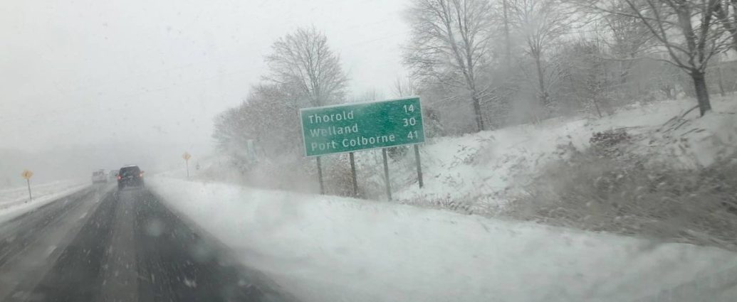
Highway conditions are going to be treacherous across Quebec’s autoroute network. The Ministère des Transports has 180 spreader trucks loaded with 45,000 tonnes of road salt, but salt becomes ineffective below -10°C and provides minimal traction improvement on glare ice surfaces. Autoroute 40 through Montreal, the Trans-Canada Highway’s Quebec segment carrying 120,000 vehicles daily, will likely see speed restrictions dropping from 100 km/h to 70 km/h or lower.
The 401 corridor connecting Montreal to Toronto, valued at $365 million in daily freight movement, faces potential closure if conditions deteriorate beyond transport safety guidelines. STM operates 1,800 buses across 219 routes serving 1.4 million daily passengers. Winter operations manager Sophie Gravel reports that buses equipped with tire chains can handle up to 15mm of ice accumulation, but service suspensions become necessary beyond that point.
The metro system’s outdoor sections, particularly on the Blue and Orange lines, remain vulnerable to power disruptions from ice-laden overhead cables.
What This Means Going Forward
School boards across the region are preparing for widespread closures Thursday. The Commission scolaire de Montréal, serving 113,000 students across 190 schools, will make closure decisions by 5 AM Thursday based on Environment Canada updates and road condition assessments from municipal partners.
Why the Lights Are Going Out (And Staying Out)
Prolonged power outages are almost guaranteed with this setup, and here’s why that’s particularly nasty for Quebec’s 4.5 million electricity customers.
Hydro-Quebec operates 34,500 kilometres of distribution lines across southern Quebec, with 750,000 wooden utility poles supporting the network.
Engineering assessments following the 1998 ice storm showed that poles rated for 19mm radial ice loading begin failing at 87% probability once accumulations exceed 30mm (not a typo). Wednesday’s forecast puts numerous areas right at that threshold.
The utility has invested $1.2 billion since 1998 in grid hardening measures, including 12,000 kilometres of underground cable installation and 85,000 polymer insulator replacements. However, economic constraints meant that rural and suburban distribution networks retained overhead configurations vulnerable to ice damage. Power restoration becomes exponentially more complex during freezing rain events.
Line crews can’t safely operate bucket trucks when ice accumulations exceed 13mm, forcing manual repairs using ladder trucks and ground-based equipment.
Restoration times increase from 2-4 hours per outage to 8-12 hours under icy conditions.
“Our crews are positioned across the province, but ice creates safety challenges that slow restoration work significantly. We’re asking customers to prepare for outages lasting several days in the hardest-hit areas,” said Hydro-Quebec emergency response coordinator Marie-Claude Blais.
Critical infrastructure protection remains a priority, with backup generators pre-positioned at 47 hospitals, 12 water treatment plants, and 156 senior care facilities across the affected regions. These diesel generators consume approximately 200 litres of fuel per hour during full operation, requiring continuous refuelling logistics throughout extended outages.
Telecommunications infrastructure faces similar vulnerabilities. Bell Canada operates 23,000 cell sites across Quebec, with battery backup systems lasting 4-8 hours depending on site configuration.
Extended power outages create expanding dead zones as tower sites go offline and backup generators run out of fuel.
Brutal.
Where It’s Going to Hit Hardest
This storm isn’t hitting everywhere equally, with topographic features and urban heat islands creating significant variations in ice accumulation across the 125,000 square kilometre impact zone.
Greater Montreal sits right in the bullseye, with downtown areas potentially seeing slightly lower accumulations due to urban heat island effects raising surface temperatures by 2-3°C. However, suburban communities like Laval, Longueuil, and the West Island face full exposure to the 20-30mm potential.
The St. Lawrence Valley acts as a natural corridor funnelling moisture-laden air masses, concentrating the worst impacts where 3.9 million people live.
The Montérégie region south of Montreal could actually see slightly higher totals.
Terrain-enhanced precipitation is possible near Mont-Saint-Hilaire and Mont-Saint-Bruno. These 400-metre elevations create orographic lifting that increases precipitation rates by 15-20% on their northern slopes, potentially pushing local accumulations toward 35mm. Outaouais residents near Ottawa-Gatineau face unique challenges from the Ottawa River valley’s microclimate. Cold air pooling in the valley bottom creates persistent below-freezing temperatures while southwest winds aloft transport warm, moist air from the Great Lakes.
This setup can extend freezing rain duration by 4-6 hours compared to surrounding areas.
The Laurentians north of Montreal present the most complex forecast challenge. Elevations above 300 metres may see mixed precipitation as temperatures fluctuate near the freezing point. Communities like Sainte-Adele and Mont-Tremblant could experience alternating periods of freezing rain, sleet, and wet snow, creating layered ice accumulations that are particularly difficult to remove.
Val-David, at 285 metres elevation, sits right on the rain-snow line where small temperature changes create dramatically different outcomes.
Current models show a 60% probability of pure freezing rain, 25% chance of mixed precipitation, and 15% possibility of mainly snow if cold air proves more persistent than forecast.
How This Compares to the Big Ones
Weather historians can’t help but compare this setup to other major ice storms in Quebec’s meteorological record.
The benchmark remains January 5-10, 1998, when an unprecedented series of three freezing rain events deposited over 100mm of ice across the Montreal-Ottawa corridor.
That legendary storm caused $5.4 billion in damages (2024 dollars), left 1.6 million customers without power, and required deployment of 15,000 Canadian Armed Forces personnel for disaster relief. Peak outages reached 1.4 million Hydro-Quebec customers simultaneously, with some rural areas remaining without power for 33 days.
This week’s event won’t approach those historic totals, but 20-30mm still ranks as significant.
Comparable storms include February 2017 (18-25mm, 320,000 outages, $45 million damage), December 2013 (15-22mm, 285,000 outages), and March 2010 (12-28mm, 425,000 outages). Each event demonstrated that ice accumulations above 20mm create cascading infrastructure failures across multiple sectors. What makes Wednesday’s storm particularly concerning is seasonal timing. March ice storms can be especially destructive because deciduous trees remain dormant without leaves to naturally shed accumulating ice.
Research by Université Laval’s forestry department shows that bare branches accumulate 40% more ice weight compared to summer conditions when leaves provide natural shedding mechanisms.
Climate data from Environment and Climate Change Canada reveals that major ice storms (20mm+) occur approximately once every 12-15 years in southern Quebec. However, warming winter temperatures have increased freezing rain frequency by 23% since 1950, as more precipitation events occur near the 0°C threshold where ice storms develop. Infrastructure aging compounds the vulnerability. Quebec’s electrical grid averages 32 years old, with many distribution components installed during the post-1998 reconstruction now approaching their 25-year design life.
Tree canopies have regrown substantially since major trimming operations in 1998-2000, creating new potential failure points near power lines.
What You Need to Do Right Now
Emergency management officials across Quebec activated Level 2 response protocols Tuesday, mobilising 2,400 personnel across affected regions. The province’s emergency preparedness budget allocates $127 million annually for natural disaster response, with $38 million reserved specifically for winter storm operations.
If you’re in the affected areas, here’s what you need to do right now, based on lessons learned from previous ice emergencies.
Public Safety Canada recommends 72-hour emergency kits, but ice storm experiences suggest planning for 7-10 days of self-sufficiency. Water is priority one, with municipal pumping stations vulnerable to extended power outages. Fill bathtubs, sinks, and every available container, targeting 4 litres per person per day minimum. Montreal’s water distribution system maintains 36 hours of gravity-fed reserves, but suburban communities with electric pumps face immediate shortages during outages.
Food should emphasise non-perishable, high-energy options requiring minimal preparation. Plan for 2,500 calories per person per day, focusing on canned proteins, nuts, dried fruits, and complex carbohydrates.
Propane camping stoves provide reliable cooking capability when electric ranges become useless, but require outdoor ventilation to prevent carbon monoxide poisoning.
Heating becomes critical as temperatures are forecast to drop to -8°C Thursday night with wind chills reaching -15°C. Homes heated by forced-air systems lose effectiveness immediately during power failures, as electric blowers stop circulating warm air. Passive solar heating through south-facing windows can provide 2-3°C temperature boost during daylight hours. Alternative heating sources require careful safety considerations. Wood-burning fireplaces can heat 150-200 square metres effectively, but require properly seasoned hardwood producing 20-24 million BTUs per cord.
Portable propane heaters designed for indoor use provide 9,000-12,000 BTU output but consume standard 20-pound cylinders in 8-10 hours of continuous operation.
What This Means Going Forward
Communication infrastructure becomes unreliable as cell towers exhaust battery reserves after 4-8 hours without commercial power. Battery-powered or hand-crank radios provide access to emergency broadcasts on AM 940 (Montreal), FM 95.1 (Quebec City), and Environment Canada weather radio on 162.550 MHz.
Medication management requires special attention during extended outages, particularly for insulin-dependent diabetics and other temperature-sensitive prescriptions.
Pharmacies may close during severe weather, making emergency supplies vital for chronic conditions. The storm itself represents just the beginning of this weather story.
The Bigger Picture for Quebec
Environment Canada meteorologists forecast that subfreezing temperatures will persist for 96 hours after freezing rain ends, complicating cleanup and recovery operations across the 8-region impact zone.
Economic impacts will ripple through Quebec’s $425 billion economy, with particular stress on manufacturing, retail, and service sectors. The Conference Board of Canada estimates that each day of widespread power outages costs Quebec’s economy $180-220 million in lost productivity, cancelled services, and emergency response expenses.
Small businesses face disproportionate challenges, with 73% lacking business interruption insurance.
Restaurants, retail stores, and personal service providers in affected areas may see revenue losses of $12,000-35,000 per day during extended closures. Healthcare system impacts extend beyond emergency departments treating slip-and-fall injuries. Home care services for 89,000 elderly Quebecers may face disruptions, while dialysis patients requiring tri-weekly treatments need alternative arrangements if neighbourhood clinics lose power.
Educational disruptions affect 1.1 million Quebec students, with school closures triggering childcare challenges for 340,000 working parents.
Remote learning becomes impossible without electricity and internet connectivity, potentially extending winter break schedules into the following week.
Transportation recovery will be phased and gradual. Montreal-Trudeau Airport expects normal operations to resume 18-24 hours after freezing rain ends, but Air Canada and WestJet have already cancelled 127 flights scheduled for Thursday. Rebooking passengers creates cascading delays extending through the weekend. Utility crews will prioritise restoration based on critical infrastructure and customer density. Hospitals, water treatment facilities, and senior care centres receive first priority, followed by high-density residential areas and major commercial districts.
Rural customers historically face the longest restoration times, sometimes exceeding 10 days for isolated farms and cottages.
What This Means Going Forward
The good news is that long-range forecasts show temperatures climbing to +3°C by Monday, March 11th, accelerating natural ice melting processes. Southwest winds at 20-25 km/h will help break up ice accumulations on power lines and tree branches, reducing the load on damaged infrastructure.
Keep monitoring Environment Canada alerts throughout this event at weather.gc.ca and through the WeatherCAN mobile app.
Conditions can change quickly with ice storms, and meteorologists will be updating forecasts every 3 hours as new model data becomes available. Report severe weather impacts to [email protected] or use the #QCStorm hashtag on social media. Municipal emergency hotlines will be staffed continuously: Montreal 311, Laval 311, Quebec City 311, and Gatineau 819-243-2345. These lines provide updates on shelter locations, warming centres, and emergency services availability as conditions evolve.
This is shaping up to be one of those storms people will remember for years, ranking among the top 5 ice events since 1998. Take it seriously, prepare properly, and stay safe out there. The next 72 hours will test Quebec’s winter resilience like few storms in recent memory.
Frequently Asked Questions
How much freezing rain is expected in Montreal?
Environment Canada is forecasting 20 to 30 millimetres of freezing rain accumulation over a 24-hour period from Wednesday to Thursday.
Which areas of Quebec will be affected by the ice storm?
The storm will impact Greater Montreal, Montérégie, Outaouais, Laurentians, Lanaudière, Mauricie, Centre-du-Québec, and the Capitale-Nationale region.
Should I travel during the freezing rain event?
Environment Canada strongly advises delaying or cancelling non-essential travel as surfaces will become extremely icy and dangerous for both driving and walking.