
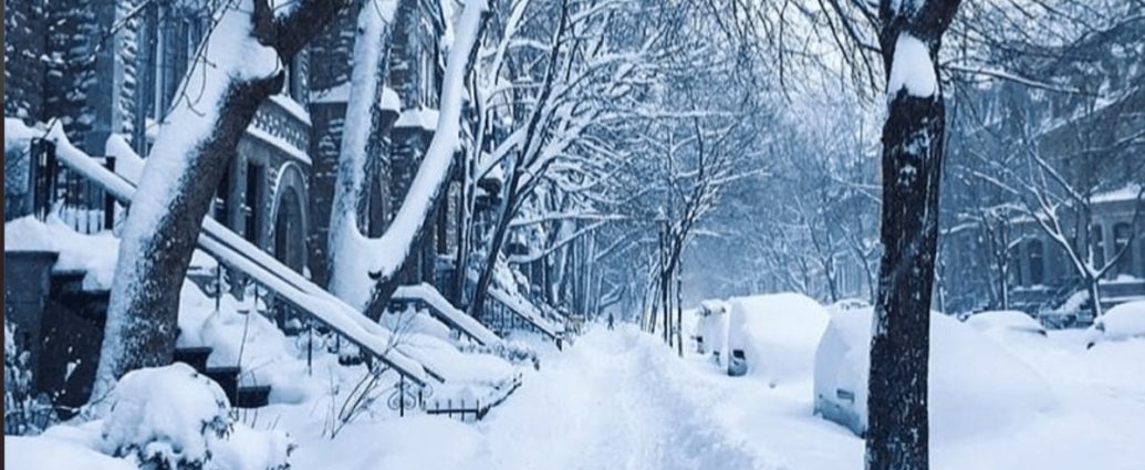
- Snowfall: 4 to 8 cm expected
- Areas: Barrie, Collingwood, Hillsdale, Innisfil, New Tecumseth, Angus
- Duration: Ending this morning
- Main hazard: Severely reduced visibility
Environment Canada’s put out a special weather statement for the Barrie-Collingwood-Hillsdale area. Heavy snow’s hammering the region right now, and it’s creating a real mess for anyone trying to get to work this morning.
We’re talking 4 to 8 cm of snow across the affected areas. But here’s what’s really scary – it isn’t how much snow we’re getting. It’s the fact that you can’t see anything out there.
This late-season blast couldn’t have picked a worse time. Thousands of people are trying to handle morning rush hour on some of Ontario’s busiest roads.
You Can’t See Where You’re Going
The snow’s coming down at more than 2 cm per hour in the heaviest bands. Visibility’s dropping below 100 metres in spots. Throw in some blowing snow, and you’ve got white-out conditions on the highways.
Barrie, Collingwood, Hillsdale, Innisfil, New Tecumseth, and Angus – they’re all getting hit hard. If you’re commuting through any of these places this morning, you’re going to have a tough time. OPP reports they’ve already dealt with 12 weather-related crashes between 6:00 AM and 8:30 AM along Highway 400 and Highway 26.
“We’re seeing multiple fender-benders and slide-offs as drivers encounter sudden white-out conditions,” said OPP Sergeant Maria Santos, spokesperson for the Central Region. “The snow is falling so heavily in some areas that visibility can go from clear to near-zero in less than a kilometre.”
Look, this isn’t going to last all day. So you probably won’t need your snow shovel. But getting to work in one piece? That’s the real challenge right now. Transportation officials are telling drivers to slow down by at least 30% and keep double the usual distance behind other cars.
Roads Are Getting Worse by the Minute
What looked fine an hour ago might be a disaster zone now. That’s how fast things are changing out there.
The Ministry of Transportation Ontario’s got 15 snow plows and salt trucks working between Barrie and Collingwood. But even with continuous plowing, they can’t keep up when snow’s falling at 3 cm per hour.
The 400 through Barrie’s being particularly nasty this morning. That stretch always gets hammered when lake-effect bands roll off Georgian Bay. And this system’s no different. About 85,000 vehicles use this section every day, making it one of the province’s most important transportation routes.
So when it gets messy, it affects a lot of people.
Highway 26 between Collingwood and Stayner’s another problem area. The hills there make the snow even heavier, and with visibility already shot because of horizontal snow, it’s creating perfect conditions for accidents. Road crews say that despite throwing down salt and sand non-stop, the snow’s piling up faster than they can treat it.
GO Transit’s announced delays of up to 45 minutes on the Barrie line.
That affects about 3,200 people who take that train every day. Bus routes in the affected areas have slowed down and aren’t running as often to keep passengers safe.
“We’re monitoring conditions minute by minute,” explained Transport Canada meteorologist Dr. James Mitchell. “These lake-effect bands can intensify and weaken rapidly, so what looks manageable one moment can become dangerous the next.”
Georgian Bay’s Feeding This Storm
What we’re seeing is classic lake-effect snow, but supercharged by the bigger weather system. Georgian Bay’s sitting at 4°C while the air temperature’s -3°C.
That 7-degree difference is perfect for cranking out snow at an exceptional rate.
Collingwood and Blue Mountain are right in the bullseye for this kind of weather setup. The hills there work like a snow-making machine when the atmosphere lines up like this. The Niagara Escarpment pushes air masses up, cooling them fast and squeezing out more moisture.
Barrie’s positioned about 15 kilometres inland from Georgian Bay – the sweet spot to catch these bands as they get organized and really intense. It’s why the city often sees twice as much snow as places just 20 kilometres east or west during lake-effect events. The numbers show Barrie gets an average of 35 cm more snow each year than Toronto, mostly because of where it sits relative to Georgian Bay.
A low-pressure system tracking through Michigan is making things worse. It’s providing extra lift and moisture to feed the lake-effect machine. Northwest winds at 25 km/h are keeping the fetch across Georgian Bay active, which keeps these snow bands parked in the same spots and really intense.
This is Costing Money
The timing couldn’t be worse for the local economy. April’s peak maple syrup season across Simcoe County, and producers are worried about getting to their sugar bushes. The region’s maple syrup industry brings in about $2.8 million each year. Weather delays during peak sap flow can really hurt yields.
Blue Mountain Resort was getting ready for spring skiing but had to shut down the lifts because you can’t see anything. The resort usually sees 15,000 visitors on April weekends.
That’s roughly $450,000 in daily economic activity for the Collingwood area.
School boards cancelled morning classes, affecting over 28,000 students across the Simcoe County District School Board and Simcoe Muskoka Catholic District School Board. Parents now have to figure out childcare, which creates problems throughout the regional workforce.
Farmers in the Holland Marsh area – they call it Ontario’s vegetable basket – are concerned about getting to their fields for spring prep.
The region produces vegetables worth over $200 million annually. Weather delays during spring preparation can mess up the entire growing season.
Short But Scary Weather Event
Here’s some good news – this won’t last all day (for better or worse). Environment Canada meteorologists think the heavy snow will stop by 11:00 AM. So we’re looking at maybe 3-4 more hours of the worst conditions.
Don’t let that fool you though.
Brief intense snowfall events cause 23% of all weather-related traffic accidents in Ontario. Drivers don’t have time to adjust when conditions change this fast, and road crews can’t get into their usual treatment routines.
School bus companies across the affected areas cancelled morning routes. That impacts about 8,500 students who depend on buses to get to school.
The Simcoe County Student Transportation Consortium made the call at 6:45 AM after talking with local police and road maintenance officials.
Emergency services are running enhanced protocols this morning.
They’ve positioned extra ambulances and fire trucks along major routes. Simcoe County Paramedic Services moved three additional units to high-traffic areas and extended shift changes to keep optimal coverage.
What This Means If You Live Here
For the 180,000 people living in these communities, this morning’s a harsh reminder that late-season snow’s still dangerous in the Great Lakes region. The sudden start and intensity highlight why you need to keep winter emergency kits in your car well into April.
Local businesses are feeling it right away. Many report reduced foot traffic and delayed deliveries. Tim Hortons locations along Highway 400 report a 40% jump in customers seeking shelter from dangerous driving conditions.
Several retail stores have delayed opening until things improve.
Healthcare facilities activated weather emergency protocols (not a typo). Critical staff are staying on-site and non-urgent appointments are being rescheduled. Royal Victoria Regional Health Centre in Barrie asked non-essential staff to avoid traveling to work unless absolutely necessary.
The region’s farming community, already preparing for spring planting, faces more challenges as this weather might delay field preparation by 2-3 days. For farms working on tight seasonal schedules, even short delays can hurt crop yields and profits.
Utility companies report minimal power outages so far.
Hydro One’s recorded only 12 weather-related outages affecting fewer than 200 customers. The dry nature of the snow and moderate winds have helped minimize problems with electrical equipment.
How This Fits Into Weather History
April snowfall in Central Ontario isn’t unheard of, but it’s becoming less common due to changing climate patterns.
Weather records show Barrie typically gets 8.7 cm of snow during April. So today’s 4-8 cm is significant but not record-breaking.
The latest recorded snowfall in the region happened on May 9, 2020, when parts of Simcoe County got 5 cm of snow. Climate data shows lake-effect snow can happen any time water temperature exceeds air temperature by more than 5°C.
That condition can last into May around the Great Lakes.
What makes this event stand out is the intensity rather than the timing. Snowfall rates over 2 cm per hour in April happen less than once every three years on average. So this morning’s conditions are pretty rare for the season.
Environment Canada keeps monitoring through its network of automated weather stations and Doppler radar systems. The agency runs 15 monitoring stations across Simcoe County, giving real-time data on temperature, wind speed, visibility, and how much it’s snowing.
What Happens Next
As the snow band moves through, attention turns to recovery and cleanup. Municipal crews are ready to start cleanup once snowfall drops below 1 cm per hour, expected around 10:30 AM.
Road salt supplies are still good across the region. Municipal stockpiles are sitting at about 75% of capacity going into this event. The City of Barrie keeps a strategic salt reserve of 4,200 tonnes, while Collingwood has 1,800 tonnes available for continued road treatment.
Weather forecasters predict temperatures will rise fast after this system passes.
Afternoon highs should reach 8°C. This temperature jump will help melt accumulated snow on paved surfaces, though shaded areas might stay slippery into the evening.
Environment Canada keeps providing updates through its weather alert system. You can check weather.gc.ca or Environment Canada’s WeatherCan mobile app.
If you’re experiencing severe weather, you can report what you see to [email protected] or post on social media using #ONStorm.
Bottom line: if you don’t have to drive in the Barrie-Collingwood area this morning, don’t. And if you do need to travel, slow way down, keep more distance between cars, turn your headlights on, and make sure you’ve got winter emergency supplies in your vehicle. This short but intense weather event reminds us that winter driving conditions can come back quickly in the Great Lakes region, even when we think spring’s here to stay.
Frequently Asked Questions
How much snow is expected in Barrie and Collingwood?
Environment Canada is forecasting 4 to 8 cm of snow across the Barrie-Collingwood-Hillsdale region.
When will the snowfall end?
The heavy snow is expected to end this morning, making it a brief but intense weather event.
What’s the main danger from this snowfall?
Severely reduced visibility is the primary hazard, rather than snow accumulation amounts, creating dangerous driving conditions.